Drone Crop Monitoring: Cutting Field Scouting Time by 80%


Walking a 200-acre field on foot can eat up your entire morning, and you'll still only see a fraction of what's actually happening with your crops. Drone crop monitoring changes that math completely. A single drone can scout over 100 acres in less than 30 minutes, turning a full day of manual inspections into a short pre-lunch flight. For farm managers and agronomists running large-scale operations, that kind of time savings isn't just nice to have. It's the difference between catching a pest outbreak early and discovering it two weeks too late.
Here's how crop monitoring drones are reshaping field scouting, and what you should know before investing.
Why Traditional Scouting Can't Keep Up
Limited Coverage
Here's the thing: visual inspections by walking the field are time-consuming, labor-intensive, and potentially less precise when limited to a small area. You're sampling, not surveying. You might check 10 spots in a 500-acre field and call it "scouted." But what about the other 490 acres?
Physical Barriers
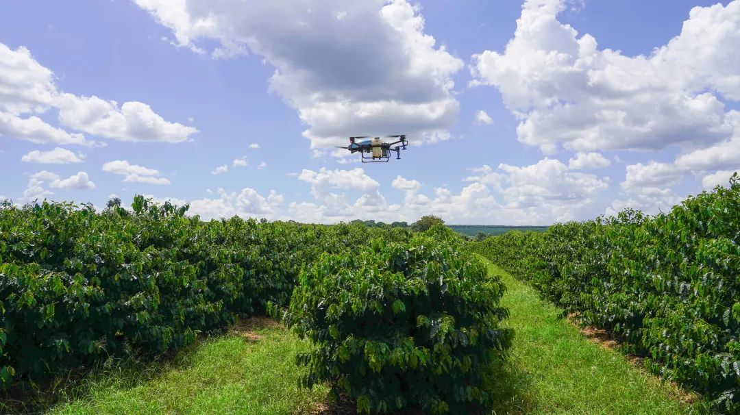
This problem gets even worse for crops like corn, which become tall, dense, and have closed canopies by tasseling, making ground-level scouting nearly impossible. The same goes for citrus orchards on hillsides or sugarcane fields with thick, hard-to-navigate rows.
Labor Shortages
And let’s be honest. Labor is getting harder to find. Acute labor shortages and growing global pressure to improve agricultural productivity are driving rapid adoption of drone technology across every major farming region.
Related article: Agriculture UAV in Precision Agriculture: How Drone Technology Is Transforming Farming
How Drone Crop Monitoring Actually Works
A crop monitoring drone isn't just a camera in the sky. These are specialized UAVs equipped with multispectral cameras, RTK positioning, and advanced data tools that deliver insights on crop health, growth stages, irrigation patterns, and potential threats like pests or disease.
The workflow is straightforward:
- Plan the mission: Set your flight path and altitude using mapping software.
- Fly the grid: The drone captures hundreds (or thousands) of images automatically.
- Process the data: Software stitches images into orthomosaics and vegetation index maps.
- Ground-truth and act: Walk only the flagged problem zones instead of the entire field.
These images get processed into orthomosaics and vegetation indices such as NDVI, OSAVI, or GNDVI. These maps help identify crop stress, disease outbreaks, and nutrient deficiencies at early stages
The Real Numbers: Time, Money, and Yield
We won't throw vague promises at you. Here's what the data shows:
|
Metric |
Traditional Scouting |
Drone Crop Monitoring |
|
Time per 100 acres |
4–8 hours on foot |
Under 30 minutes |
|
Coverage accuracy |
5–10% of field sampled |
100% of field mapped |
|
Early disease detection |
Often missed |
Can boost crop yields by up to 25% |
|
Input reduction (fertilizer/pesticides) |
Blanket application |
Up to 30% reduction through targeted use |
|
Chemical usage savings |
Minimal |
Up to 35% reduction by precisely targeting treatment areas |
UNH researchers found that drone-based multispectral surveys detected fungal disease pressure in corn weeks before symptoms were visible at ground level, giving farmers a wider treatment window. That's the kind of lead time that saves an entire field.
From Monitoring to Action: Closing the Loop
Here's where most drone monitoring setups fall short. You've got a beautiful NDVI map, but now what?
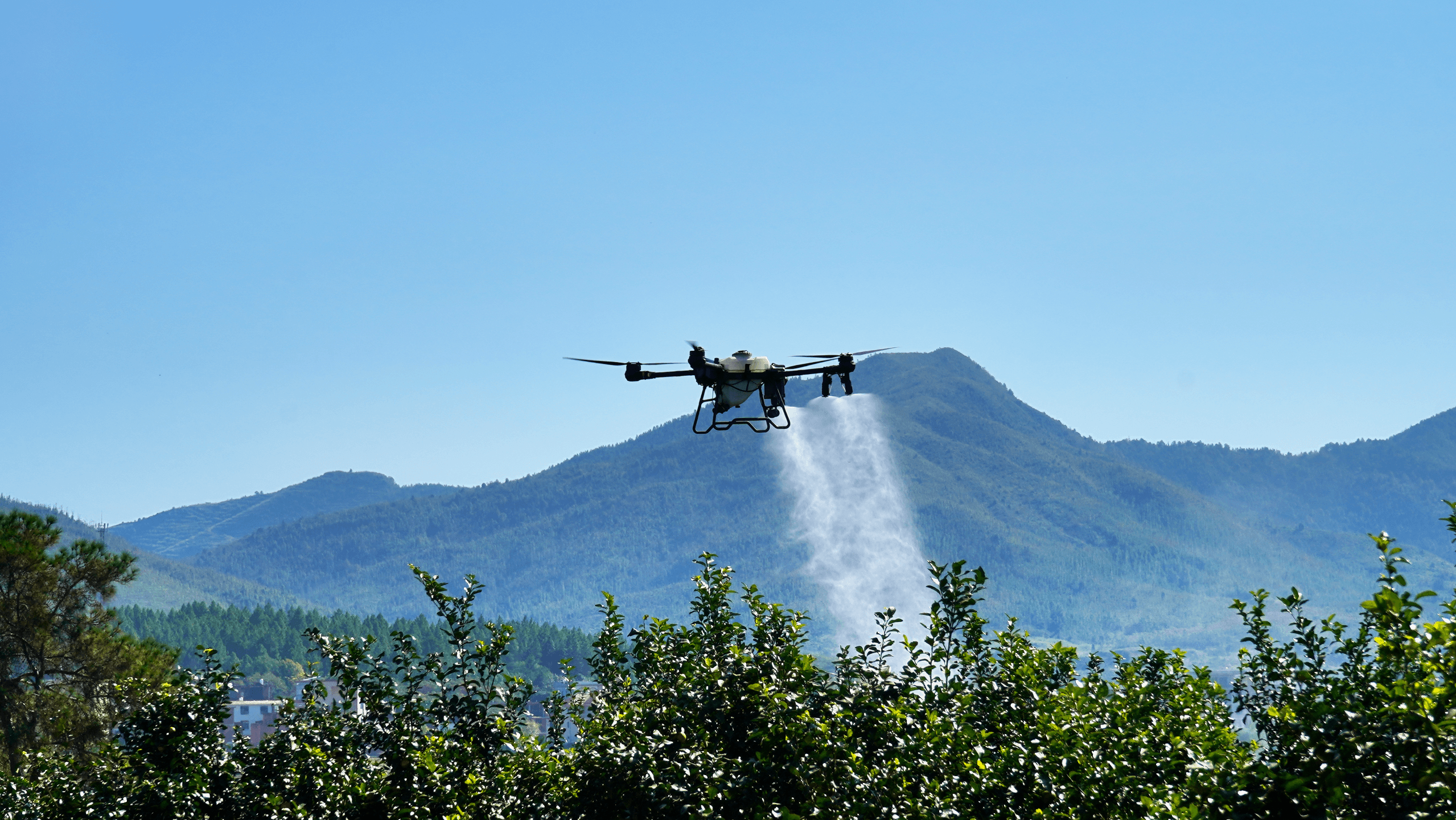
The real ROI comes when you connect scouting data to targeted action, such as precision spraying, variable-rate fertilization, or spot treatment. That's why we built our precision spraying and spreading solutions to work hand-in-hand with field mapping data. With continuously adjustable droplet sizes from 10 to 300μm, you can go from identifying a pest hotspot to treating only that zone within the same operation window.
In one Southwest Chinese sugarcane farm trial, EAVISION UAVs matched the output of traditional manual labor but did so at fifty times the speed and boosted sugar production by 3%. A citrus farm in Guangxi province showed a 90% improvement over traditional labor in preventing spider mites.
Agricultural Drone Mapping for Orchards and Complex Terrain
The sugarcane and citrus examples above came from relatively controlled environments. But what if your fields look nothing like a flat test plot?
Flat grain fields are the easy part. The real test for any crop monitoring drone is how it handles hilly orchards, mixed-canopy fruit farms, or uneven terrain.
This is where we think EAVISION stands apart. Our EA-J150 agricultural drone is the latest in a product line built specifically for these challenging environments. EAVISION makes it possible for these sectors to benefit from automation despite demanding geographical constraints.
Our drone systems combine LiDAR, binocular vision, and AI-powered autonomous flight to follow canopy contours in real time, whether you're flying over citrus trees in Brazil, apple orchards in Spain, or tea plantations in Vietnam.
What to Look for in a Crop Monitoring Drone
Not all agricultural drones are built the same. If you're evaluating options for your operation, here's a quick checklist:
- Sensor compatibility: Can it carry multispectral or thermal cameras?
- RTK positioning: Centimeter-level accuracy matters for repeatable flights.
- Obstacle avoidance: Non-negotiable for orchards or hilly terrain.
- Flight time and coverage: Match these to your field size.
- Data integration: Can outputs feed into your existing farm management system?
- Multi-function capability: A drone that scouts and sprays saves you from buying two platforms.
Key Takeaways
Drone crop monitoring isn't a future trend. It's happening right now on farms across five continents. The global agricultural drone market is valued at roughly $5.86 billion in 2025 and is expected to reach $23.73 billion by 2032, with field mapping and monitoring contributing the highest application share at 34.7%.
Whether you're an agronomist, a drone service provider, or a farm management company, the path forward is clear: scout faster, act sooner, and waste less. And if your fields involve complex terrain or high-value specialty crops, make sure your drone is actually built for the job.
FAQs
How much time does drone crop monitoring actually save?
Most operators report 80–90% time savings compared to ground scouting. Agricultural drones can cover up to 500 acres in a single day, compared to weeks with traditional methods, saving up to 90 percent of time. The exact savings depend on field size, terrain, and how many flights you run per season.
Can agricultural drones work in orchards and hilly areas?
Yes, but not all drones handle it well. You need a system with real-time obstacle avoidance and terrain-following capabilities. EAVISION UAVs offer exceptional stability when flying over hilly areas, and superior object detection allows for safe navigation in mixed tree crop vegetation with complicated gradients.
What's the difference between RGB and multispectral drone mapping?
An RGB camera captures only visible light (Red, Green, Blue) and is useful for visual assessments like counting plants or detecting weeds. A multispectral sensor captures additional light bands like near-infrared, enabling vegetation indices such as NDVI and GNDVI that reveal crop stress invisible to the human eye.
Is drone crop monitoring worth it for smaller farms?
It depends on your crop value and the cost of missed problems. Crop health scanning typically runs $8–$20 per acre, which pays for itself quickly if it catches an early-stage disease or saves you from a blanket herbicide application. Even 50-acre specialty crop farms often see strong returns.
Do I need a separate drone for monitoring and spraying?
Not necessarily. Multi-function platforms like the EAVISION EA-J150 combine spraying, spreading, lifting, and mapping in a single system, helping reduce equipment overhead and simplify operations across the season.